Boston Harbor
and Massachusetts Bay
Massachusetts
Water Resources Authority
| Archive |
Environmental Monitoring Data
from Boston Harbor & Tributary Rivers
The Massachusetts Water Resources Authority's (MWRA) has
been monitoring water quality in Boston Harbor and its tributary rivers since
1989. Collecting long-term water quality data helps to identify
changes in water quality over time. MWRA monitors water quality
at
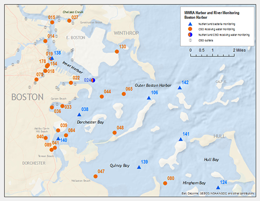
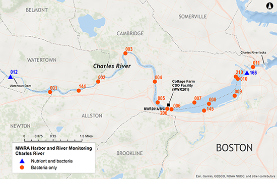
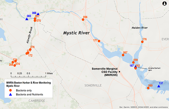
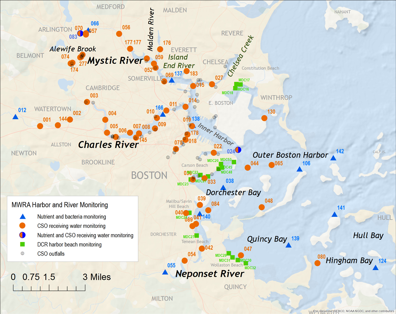
more than 70 locations in Boston Harbor and its tributary rivers. Boston Harbor is an estuary--a marine ecosytem where
fresh water from the rivers enters the ocean. The largest rivers draining into
Boston Harbor are the Charles, Neponset, and Mystic. Since
1989, MWRA has regularly monitored water quality in these rivers, measuring bacteria, algae,
water clarity, dissolved oxygen, nutrients, and suspended
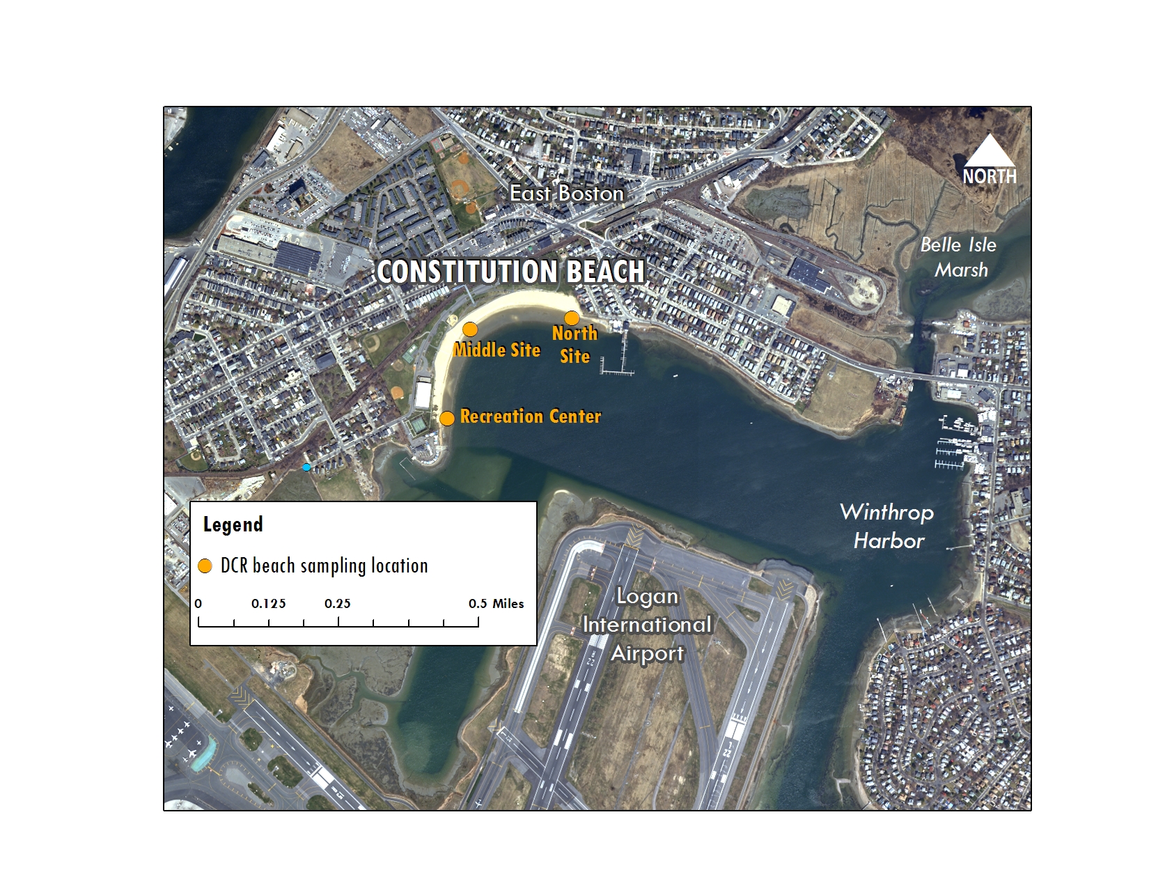
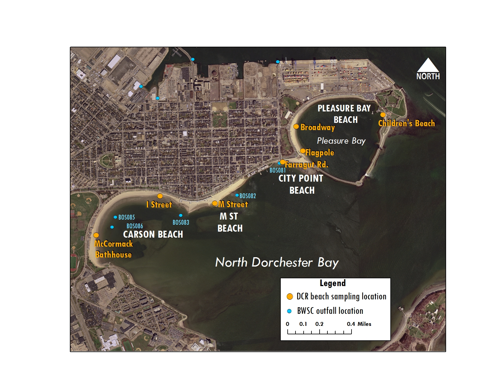
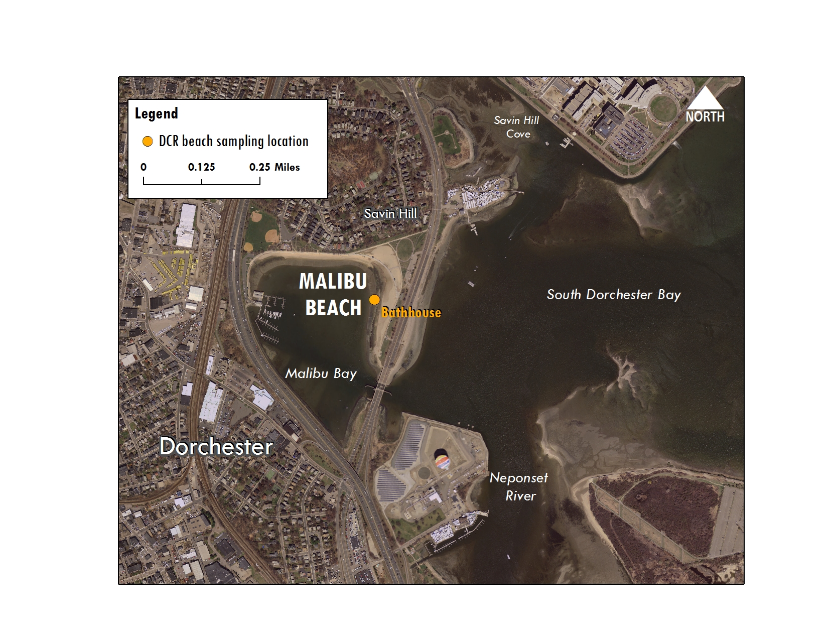
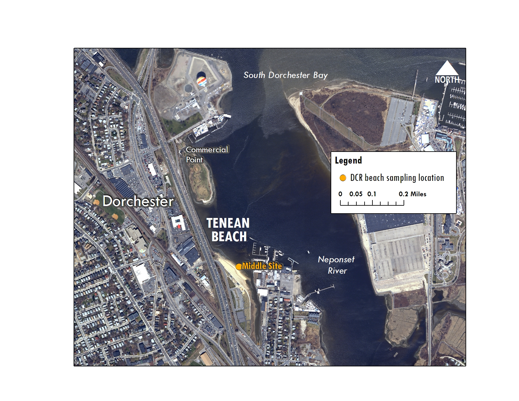
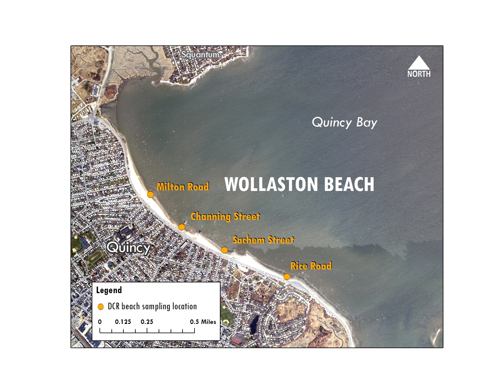
solids. Boston Harbor and River Monitoring Data Detailed sampling location map ________________________________________________________________ Water quality at Wollaston, Carson, Constitution, Tenean and Pleasure Bay beaches is tested by the Department of Conservation and Recreation (DCR) with assistance from the Massachusetts Water Resources Authority. For more information and other beach water quality links, visit MWRA's Boston Harbor Beaches page. 2018 Data
How we manage water quality data
|