FOR IMMEDIATE RELEASE
Ria Convery, MWRA
(617) 788-1105, ria.convery@mwra.com
Joshua Ostroff, Natick,
(508) 654-3330 or joshua@ostroff.net
The Town of Natick and MWRA
Celebrate Opening of New Aqueduct Trail |
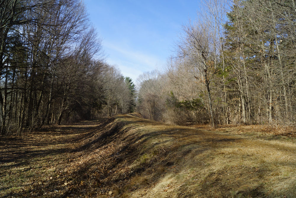
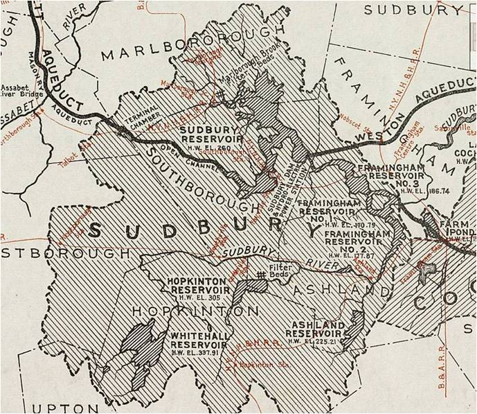
The Town of Natick and the Massachusetts Water Resources Authority (MWRA) today celebrated the opening of public trail along the Sudbury Aqueduct. The 1.5-mile section was made possible by a 2012 MWRA policy allowing public access on inactive aqueducts in Metro West, through partnerships with local communities. “The Patrick Administration is committed to working with our local partners to promote open space access and connect people to the outdoors,” said Energy and Environmental Affairs Secretary Rick Sullivan, who chairs the MWRA board. “These aqueducts follow miles of scenic, tree-lined paths across the landscape, which provide a great addition to the open space in these communities." The trail runs from Memorial Elementary School on Eliot Street westward to Cottage Street. It connects with the Town’s Eisenmenger Trail that runs to Natick Center, and is adjacent to the popular Natick Community Organic Farm. ”We are grateful to the MWRA for its vision and stewardship in providing a wonderful recreational asset for residents to enjoy,” said Josh Ostroff, Chair of the Natick Board of Selectmen. “The MWRA, the Metropolitan Area Planning Council and the Town’s Conservation Commission Town have established a strong working relationship that will benefit the community for generations.” “I am thrilled that we can open up public land to the public today,” said Joel Barrera, MWRA Board Member and Deputy Director of the Metropolitan Area Planning Council. “If we have a long-term vision and action plan, we have the opportunity to open up almost 40 miles of trails, creating partnerships with municipalities to open up section after section. We are taking down the no trespassing signs and putting up trail signs.” The Metropolitan Area Planning Council (MAPC) has championed this effort and is using a federal Community Transformation Grant, in partnership with the Massachusetts Department of Public Health, to provide design and trail planning assistance to municipalities. The 2012 MWRA policy makes available nearly 40 miles of trails for public use along the Sudbury, Weston, Wachusett and Cochituate Aqueducts. “The program has been well received by the communities,” said Fred Laskey, MWRA’s executive director. “To date, nearly 15 miles of trails have been permitted in five communities with more coming soon.” MWRA will retain care and control as some of the aqueducts still serve as emergency back-up for the region’s water supply system. Details of the policy include:
The aqueducts also run through the communities of Berlin, Boston, Clinton, Framingham, Marlborough, Needham, Newton, Northborough, Sherborn, Southborough, Wayland, Wellesley, and Weston. |
|
|||||||||||
### |
||||||||||||
Follow us
|
|||
Posted April 24, 2014